Profiling buoys are oceanographic observation platforms that can move vertically through the water column to measure parameters such as temperature, salinity, pressure, currents, and biogeochemical properties. Unlike fixed surface buoys that record data at a single depth, profiling buoys travel up and down between specific depths and the surface, providing a vertical profile of ocean conditions.
The buoys is equipped with :
- Automaton
- Air sensors: weather station, GPS
- Battery and solar panels
- Profiling float: CTD, Do, Fluo
- GPRS modem with antenna
- Positioning light
The main function of these Profiling Buoys is :
- To measure the water column profile (vertical) such as temperature, salinity, DO, pressure and turbidity.
- Marine climate & weather monitoring => useful for studies of climate change, el nino and ocean dynamics.
- Support navigation & fisheries => temperature and salinity data helps predict fish migration.
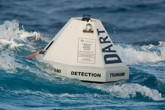
- Tsunami early warning system (if seabed pressure sensors are installed).
Types of Profiling Buoys
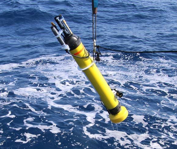
- Argo float, the most famous and part of the international Argo Program. He can dive to 2.000 meters and transmit data via satellite, and has an operational life of 3 – 5 years.
- Glider profiling buoys, it similar to marine drones, they move by changing buoyancy. The advantage he can travel thousands of kilometers, saving energy.
- Moored profiling buoys, the anchor line remains fixed to the seabed, while the sensor moves up and down along the cable, suitable for monitoring specific locations.
Main Components of Profiling Buoys
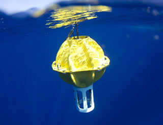
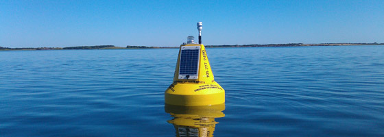
1. Surface Buoys/Float Body :
- The part that floats on the surface of the sea.
- It serves as the primary housing for instruments, communication systems, and power sources.
- Made of corrosion- and wave-resistant materials (usually fiberglass, aluminum, or composite plastic).
2. Power System :
- Rechargeable batteries (lithium-ion) → as the main power source.
- Equipped with solar panels (for fixed surface buoy type).
- Provides power for sensors, actuators, and communication modules.
3. Oceanographic Sensors :
- CTD sensor (Conductivity, Temperature, Depth) → for salinity, temperature, and pressure.
- DO sensor
- Fluorometer → to detect chlorophyll & primary productivity.
- Turbidity sensor → water clarity..
- ADCP (Acoustic Doppler Current Profiler) → for ocean currents.
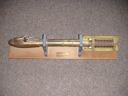
4. Buoyancy Engine / Winch System :
- The mechanism that allows the buoy or sensor to move up and down in the water column
- Buoyancy pump system → regulates buoyancy by filling/discharging oil into the external chamber.
- Winch system → the sensor is pulled/lowered by a motor cable (common on moored buoys).
5. Communication System :
- Sending data from the sea to research centers via satellite (iridium, argos, inmarsat) and radio
- Equipped with GPS antenna for positioning & time synchronization.
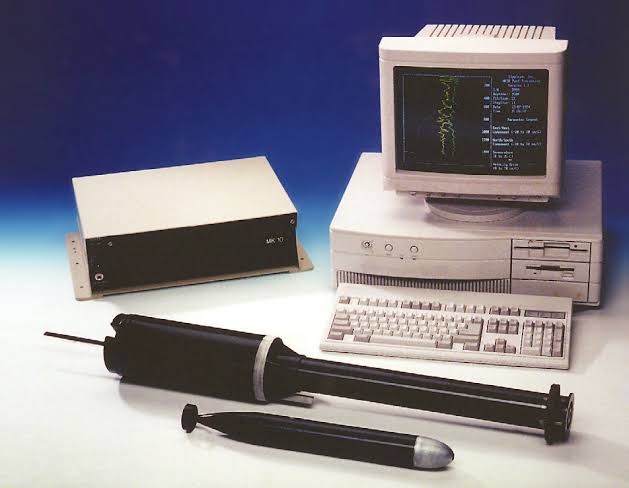
6. Control & Data Logger :
- The main of the system → is a microprocessor / small computer.
- Manages sensor operations, profiling cycles, data storage, and transmission.
- Programmable (e.g. dive every 10 days, up to a depth of 2000 m).
7. Body & Housing
- Protective structure of all components, designed to withstand high pressure, seawater corrosion, and wave impact.
- Usually equipped with anti-biofouling coating so that it doesn’t quickly become covered in marine organisms.

How Profiling Buoys Work
Profiling buoys operate as autonomous oceanographic instruments that repeatedly dive and ascend through the water column to measure key properties of seawater. Once deployed, typically from research vessels or commercial ships, a buoy sinks to a designated “parking depth” where it drifts with subsurface currents. At scheduled intervals, the buoy activates its buoyancy engine, usually an oil pump or inflatable bladder that changes its density relative to the surrounding water, allowing it to descend to deeper layers and then rise toward the surface. During this vertical journey, sensors record temperature, salinity, pressure, and in some models additional parameters such as dissolved oxygen or nutrients. When the buoy reaches the surface, it transmits the collected data to satellites like Iridium or Argos, which then relay the information to data centers worldwide. After transmission, the buoy adjusts its buoyancy to return to its parking depth, repeating this cycle autonomously for several years. This continuous operation makes profiling buoys indispensable for monitoring global ocean conditions, improving climate models, validating satellite observations, and supporting regional studies of ocean dynamics.
Profiling Buoys strengths and weaknesses
Strengths
One of its main advantages is the ability to conduct long-term and continuous monitoring of ocean conditions without always involving expensive research vessels. This instrument can also cover a wide area with global distribution, such as the Argo Float program spread throughout the world’s oceans, so the resulting data is more representative for climate studies and ocean dynamics. In addition, profiling buoys can measure ocean parameters vertically from the surface to depths of thousands of meters, providing a detailed picture of the structure of the air column that is crucial for understanding phenomena such as El Niño, thermohaline circulation, and climate change. Another advantage is that the collected data can be transmitted in real time via satellite, thus supporting early warning systems and rapid decision-making in the fields of maritime affairs, fisheries, and disaster mitigation.
Weakness
Most buoys are equipped only with basic physical sensors, with limited biogeochemical capabilities due to battery life and payload capacity constraints. This limits their ability to measure parameters such as nutrients or pH extensively. Their performance is also reduced in ice-covered areas, shallow coastal waters, and marginal seas, where the risk of grounding or damage is higher.
Writer : Surveyor 15