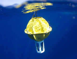
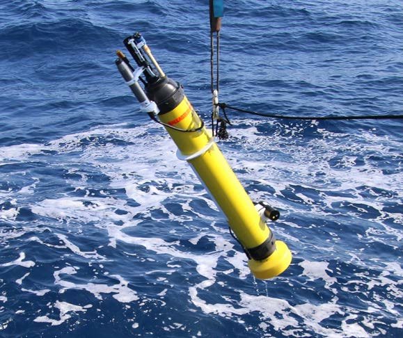
Waverider Buoy is a specialized oceanographic instrument designed to accurately measure wave characteristics at sea. It is typically a spherical or disc-shaped floating device that follows the motion of the sea surface, making it highly suitable for tracking wave behavior. The buoy is moored to the seabed using an elastic tether, allowing it to move freely with the waves while maintaining its location.
This instrument is equipped with high-precision accelerometers, a compass, GPS, and onboard processing systems. These sensors allow the buoy to measure :
Significant wave height (Hs),
Wave period (T),
Wave direction (for directional models),
Sea surface temperature (SST).
The data output is typically presented in several formats. A common visualization includes:
Time Series Graph of Significant Wave Height (Hs)
This shows how wave height changes over time, often in hourly or 30-minute intervals.Wave Energy Spectrum
This illustrates how wave energy is distributed across various frequencies. It helps determine the presence of swell vs local wind waves.Directional Wave Spectrum (for directional buoy)
A polar plot indicating the incoming direction of wave energy and its strength.
Buoyant Hull (Float Body)
Made of durable, waterproof materials (e.g., fiberglass or foam).
Floats on the sea surface and moves naturally with waves.
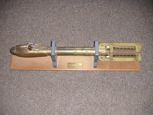
Vertical and Horizontal Accelerometers
Measure vertical (heave) and horizontal (pitch and roll) motion of the buoy caused by waves.
Core component for calculating wave height and period.
Fluxgate Compass: Used in directional buoys to determine the orientation of wave direction.
GPS Module
Tracks the exact location of the buoy.
In some models, also used to derive wave direction and speed.
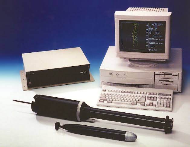
Data Logger and Processor: Collects data from sensors and processes it to extract wave parameters like wave height, direction, and frequency spectrum.
Power Supply (Battery System)
Typically uses long-lasting lithium batteries.
Powers the sensors and transmission system for extended deployments (months to years).
Communication System
Sends data to shore via satellite (Iridium), GSM, HF radio, or AIS.
Enables real-time wave monitoring from remote locations.
Mooring System
Elastic tether connected to a seabed anchor.
Allows the buoy to move with the waves without drifting away.
Protective Casing and Marine Lights
Waterproof enclosure to protect internal electronics.
Equipped with navigation lights or reflectors for visibility to ships.
Optional Environmental Sensors: May include sea surface temperature, salinity, or atmospheric pressure sensors depending on the model.

https://www.researchgate.net/figure/Diagram-depicting-the-Spotter-buoy-mooring_fig2_364355591
How Waverider Buoys Work
Accelerometer Sensor & Stabilized Platform
An accelerometer is mounted on a stabilized platform within the buoy. This sensor accurately measures vertical motion (heave).
Significant Wave Height (Hsig) Measurement
Motion data is transmitted to an onboard module that calculates the significant wave height (Hsig) — defined as the average height of the highest one-third of waves during the sampling period.
Wave Direction Measurement
In directional waveriders, additional horizontal accelerometers (north-south and east-west) and a compass are installed, allowing for the determination of wave direction.
Signal and Spectral Processing
Acceleration data is processed using Fast Fourier Transform (FFT) to obtain the wave frequency spectrum. RAO (Response Amplitude Operator) correction is applied to eliminate noise.
Data Transmission
Results can be transmitted via HF radio, satellite (Iridium, GSM), or stored on an internal data logger. Some models also include GPS and AIS for tracking purposes.
Waverider Buoys strengths and weaknesses
Strengths
- Accurate Wave Measurements : Provides precise data on wave height, period, and direction using high-quality sensors.
- Real-Time Monitoring : Equipped with communication systems (e.g., satellite, HF radio) for real-time data transmission to shore stations.
- Long-Term Operation : Capable of operating autonomously for several months or even years with minimal maintenance.
- Directional Capability : Advanced models can detect the direction of wave propagation, useful for forecasting and engineering applications.
- Durable and Weather-Resistant : Built to withstand extreme marine environments including strong winds, high waves, and saltwater exposure.
- Standardized and Trusted : Used worldwide and accepted in scientific, operational, and regulatory settings (e.g., coastal planning, offshore platforms).
Weakness
- High Cost : Expensive to purchase, deploy, and maintain—especially for directional versions.
- Limited Coverage : Measures wave conditions at a single point; multiple buoys are needed for spatial coverage.
- Vulnerable to Fouling : Biofouling by marine organisms can interfere with buoy movement and sensor accuracy over time.
- Mooring Challenges : Requires careful mooring system design; can be difficult to deploy in deep or rough waters.
- Risk of Damage : Susceptible to collisions with ships or entanglement in fishing gear.
- Maintenance Needs : Requires periodic retrieval for cleaning, calibration, or battery replacement.
Writer : Tasya Nadya