Multibeam echosounder (Multibeam Echosounder (MBES)) is an important breakthrough in subsea mapping technology, significantly enhancing marine survey capabilities. As an evolution of the singlebeam echosounder, Multibeam Echosounder (MBES) introduces an impressive innovation with its ability to generate a large number of ‘beams’ simultaneously, which overcomes the coverage and spatial resolution limitations of its predecessors. By utilizing this principle, Multibeam Echosounder (MBES) not only extends the survey range, but also improves the accuracy of seafloor mapping, making it the instrument of choice in deep-sea exploration, seafloor mapping and understanding of underwater ecosystems. These improvements bring significant positive impacts in human understanding of seafloor dynamics as well as the sustainable utilization of undersea resources.
A multibeam echosounder (Multibeam Echosounder (MBES)) is a marine instrument specifically designed for underwater mapping and surveying. It uses sonar principles to generate highly detailed spatial data about the topography of the seafloor. Unlike the singlebeam echosounder, Multibeam Echosounder (MBES) can transmit and receive a large number of sound ‘beams’ simultaneously, covering a wider area and providing higher resolution. The main advantage of Multibeam Echosounder (MBES) lies in its capacity for efficient surveying, and one of its distinctive features is its ability to produce wide coverage, up to 180 degrees. When the sound signal reaches the seafloor, its return travel time is recorded and analyzed to produce detailed maps that include seafloor elevation and characteristics. The advantage of Multibeam Echosounder (MBES) lies not only in its capacity for efficient surveying, but also in its ability to provide accurate three-dimensional images of the subsea relief. The instrument is widely used in a variety of applications, including geological mapping, deep-sea research, undersea resource exploration and navigation purposes for safe shipping.
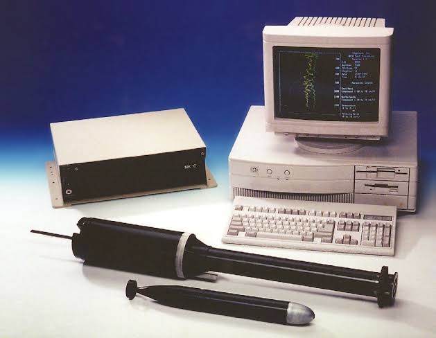
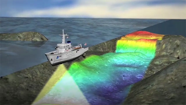
How Singlebeam Echosounder Work
The way a Multibeam Echosounder (Multibeam Echosounder (MBES)) works involves using a large number of sound ‘beams’ that are emitted simultaneously in multiple directions to cover a larger area. Here are the main steps of how Multibeam Echosounder (MBES) works:
1. Multibeam Signal Delivery: Multibeam Echosounder (MBES) uses a series of transducers or transducer elements to generate a large number of sound ‘beams’ simultaneously. Each ‘beam’ is sent to the seafloor at a different angle.
2. Sound Wave Propagation: The sound ‘beams’ propagate through the water and reach the seafloor. Since a large number of ‘beams’ are transmitted simultaneously, Multibeam Echosounder (MBES) is able to cover a large area with each measurement cycle.
3. Reflected Wave Reception: Each ‘beam’ that reaches the seafloor is reflected back to the water surface. The same transducer used for transmission also serves as a receiver to detect the reflected sound waves.
4. Travel Time Measurement for Each Beam: The Multibeam Echosounder (MBES) records the time it takes for each ‘beam’ to reach the seafloor and return. This time data is collected for each ‘beam’ emitted.
5. Data Processing and Mapping: By comparing the travel time of each ‘beam’ and considering the speed of sound in water, the Multibeam Echosounder (MBES) system can calculate the depth at each point within the survey area. This data is then processed and used to create detailed maps of the seafloor, including elevation and other underwater features.
The main advantage of Multibeam Echosounder (MBES) lies in its ability to provide highly detailed and accurate mapping of a large area in a single measurement cycle. This makes it a top choice for underwater surveys involving topographic mapping of the seafloor, underwater object searches and marine geological research. Although more complex in design and operation compared to a singlebeam echosounder, Multibeam Echosounder (MBES) offers significant efficiency in subsea surveys and provides invaluable information in a wide range of marine applications.
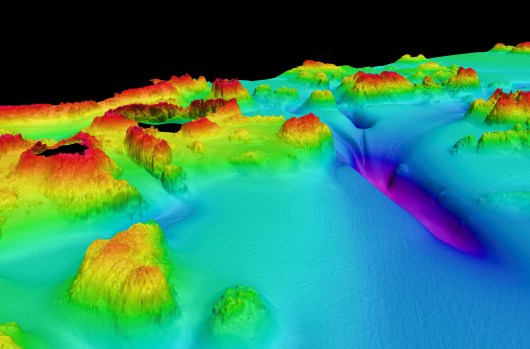
Multibeam Echosounder Visualization Result
Data acquired from a Multibeam Echosounder (MBES) is processed using specialized software to produce an informative visualization of the seafloor topography. Data processing involves interpreting the travel times of a large number of emitted and reflected ‘beams’, enabling the calculation of depth at each survey point. As a result, detailed maps and visual representations of the underwater relief can be created, including information on elevation, seafloor structure and other underwater features. These visualizations not only provide an in-depth picture of seafloor conditions, but also provide a foundation for further analysis in a variety of marine contexts, including geological surveys, navigation, and understanding marine ecosystems.
Writer : Muhammad Bahrul Anwari